





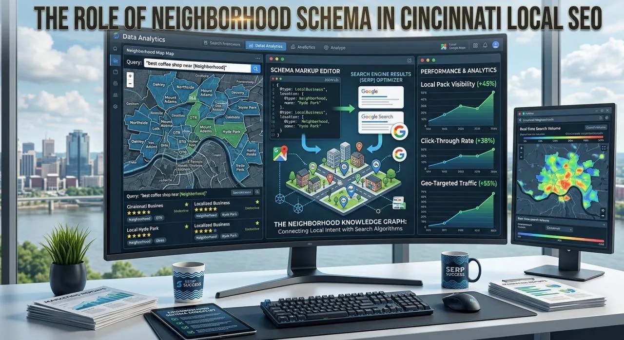
In an increasingly competitive digital landscape, local search engine optimization requires far more than basic keyword targeting and standard Google Business Profile management. For businesses operating in multi-faceted metropolitan areas like Cincinnati, establishing clear spatial relevance is critical. Search engines continually refine how they interpret physical location, moving beyond city-level boundaries to understand hyper-local micro-regions. Implementing structured data, specifically structured geographic entities, allows search engine crawlers to map your precise service footprint across distinct communities.
Understanding how structured geographic data communicates location hierarchy enables local businesses to capture high-intent search traffic across specific sub-markets. This comprehensive guide explores how location-specific structured data works, its technical implementation, its impact on local search visibility across Queen City neighborhoods, and key best practices for long-term optimization.
Understanding Structured Data and Local Geographic Entities
Search engines rely on complex entity mapping to understand real-world relationships between businesses, services, and geographic regions. While standard content on a webpage indicates where a business operates through text mentions, structured markup provides a standardized machine-readable layer that explicitly defines those relationships without ambiguity.
[ LocalBusiness Entity ] ──► [ areaServed Property ] ──► [ AdministrativeArea / Place ] ──► [ Specific Neighborhood / Zip ]
When search crawlers index a local website, they parse general text to infer service areas. However, text alone can be ambiguous. For instance, referencing “Hyde Park” could refer to a neighborhood in Cincinnati, an area in Chicago, or a district in London. By utilizing schema vocabulary, a business explicitly defines its location using precise entity identifiers, geographic coordinates, and parent organization linkages.
Why Hyper-Local Targeting Matters in Cincinnati
Cincinnati’s urban and suburban geography is defined by distinct, self-contained neighborhoods, each with its own commercial hubs and localized search patterns. Consumers rarely search for broad terms when seeking immediate local services; instead, they query specific districts or nearby commercial corridors.
1. Navigating Unique Neighborhood Geographies
From historic urban pockets like Over-the-Rhine and Mount Adams to vibrant residential hubs like Oakley, Hyde Park, Clifton, and Northside, consumer search intent in Cincinnati is deeply localized. A resident in OTR looking for a coffee shop, contractor, or boutique will include neighborhood modifiers in their queries rather than searching for generic city-wide terms.
2. Differentiating Adjacent Micro-Markets
Cincinnati’s topography, punctuated by hills, river basins, and distinct neighborhood borders, creates clear commercial divisions. Service-based businesses operating out of Blue Ash or Mason need to signal their reach into downtown neighborhoods without confusing search engines about their physical headquarters versus their broader service coverage.
3. Strengthening the Local Knowledge Graph
Search engines construct localized Knowledge Graphs to power proximity-based search results and map interfaces. Explicitly marking up local geographic areas helps search algorithms connect your business entity directly to recognized regional landmarks and administrative zones within the city’s broader ecosystem.
Technical Foundations of Geographic Structured Data
To communicate localized service areas effectively, schema frameworks offer specific properties designed to anchor a LocalBusiness entity to defined geographic boundaries.
Key Schema Properties for Location Markup
-
@type: Defines the specific business classification (e.g., HVACBusiness, LegalService, Dentist, Restaurant).
-
areaServed: Specifies the geographic region or neighborhood where the business provides services or accepts customers.
-
location: Defines the physical coordinates or postal address of the business headquarters or storefront.
-
containedInPlace: Establishes hierarchical geographic relationships, indicating that a smaller neighborhood sits within a larger municipality or county.
-
sameAs: Links the structured geographic entity directly to an authoritative external reference, such as a Wikipedia article or Wikidata entry for that specific neighborhood.
Deep Dive: Implementing Neighborhood Schema Markup for Maximum Impact
Properly embedding neighborhood schema markup into your site’s JSON-LD code ensures that search engine bots immediately grasp your hyper-local relevance without relying on guesswork. By referencing authoritative Wikidata entity IDs alongside precise geographic names, your code establishes an unassailable link between your services and specific local communities.
Below is an example of JSON-LD code demonstrating how a local service business in Cincinnati can define its primary location while explicitly marking up surrounding target neighborhoods:
{
  "@context": "schema.org",
  "@type": "Plumber",
  "name": "Queen City Plumbing Specialists",
  "image": "domain.com/assets/logo.png",
  "@id": "domain.com/#plumber",
  "url": "domain.com",
  "telephone": "+1-513-555-0199",
  "priceRange": "$$",
  "address": {
    "@type": "PostalAddress",
    "streetAddress": "1234 Vine St",
    "addressLocality": "Cincinnati",
    "addressRegion": "OH",
    "postalCode": "45202",
    "addressCountry": "US"
  },
  "geo": {
    "@type": "GeoCoordinates",
    "latitude": 39.1031,
    "longitude": -84.5120
  },
  "areaServed": [
    {
      "@type": "AdministrativeArea",
      "name": "Over-the-Rhine",
      "sameAs": "wikidata.org/wiki/Q7113361"
    },
    {
      "@type": "AdministrativeArea",
      "name": "Hyde Park",
      "sameAs": "wikidata.org/wiki/Q5953457"
    },
    {
      "@type": "AdministrativeArea",
      "name": "Oakley",
      "sameAs": "wikidata.org/wiki/Q7074121"
    },
    {
      "@type": "AdministrativeArea",
      "name": "Mount Adams",
      "sameAs": "wikidata.org/wiki/Q6920211"
    }
  ]
}
Comparative Analysis of Local Location Markup Strategies
Different approaches to location markup yield varying levels of detail and search engine comprehension. The table below compares common methods used by local businesses.
| Strategy Type | Implementation Detail | Search Engine Clarity | Risk of Confusion | Primary Best Use Case |
|---|---|---|---|---|
| City-Level Basic | Generic addressLocality marked as “Cincinnati” | Moderate | Low | Single-location storefronts with no outside service radius |
| Zip Code Radius | Multiple postal codes listed under areaServed | Moderate to High | Low | Logistics, courier, and delivery-based businesses |
| Named Neighborhoods | Neighborhood names listed as text under areaServed | High | Low to Moderate | Local service providers targeting specific residential zones |
| Wikidata Linked Entities | Neighborhoods paired with sameAs authoritative entity references | Very High | Negligible | Hyper-local service brands competing in high-density areas |
| Multi-Location Hierarchy | Nested containsPlace and nested LocalBusiness nodes | Maximum Complexity | Low (if validated) | Regional franchises with distinct neighborhood offices |
Best Practices for Hyper-Local Schema Strategy
Implementing location-based structured data effectively requires more than copy-pasting code blocks. To maximize local organic visibility and avoid technical penalties, follow these core strategy rules:
1. Maintain Strict On-Page Alignment
Schema markup should always reflect the visible content on the webpage. If you list specific neighborhood entities inside your JSON-LD script, ensure those same neighborhoods are naturally discussed in the body copy, service area lists, or localized case studies on the page. Discrepancies between structured data and user-visible text can trigger structured data warnings.
2. Leverage Authoritative Entity References (sameAs)
To eliminate ambiguity, use the sameAs property pointing to canonical Wikidata or Wikipedia entity identifiers for each Cincinnati neighborhood. This provides search engines with a definitive reference point, ensuring your target area is linked directly to the recognized geographic entity in the global Knowledge Graph.
3. Avoid Over-Stuffing Service Areas
While it can be tempting to list dozens of neighborhoods across Hamilton County, Clermont County, and Northern Kentucky, over-extending your declared service area can dilute your core local relevance signal. Focus your schema markup on the key neighborhoods where you actively operate, maintain client bases, or maintain physical storefronts.
4. Integrate Location Pages with Dedicated Markup
If your website utilizes dedicated landing pages for specific target neighborhoods (e.g., /services/plumbing-oakley-oh), ensure that the schema markup on each specific landing page narrows its areaServed property to focus directly on that single neighborhood, rather than repeating the full city-wide list across every URL.
Measuring the Search Impact of Neighborhood Markup
Evaluating the performance of structured location markup involves tracking key local search metrics over time.
[ Deploy Code ] ──► [ Validate in Search Console ] ──► [ Track Local Grid Rankings ] ──► [ Analyze Organic Conversion Rates ]
-
Rich Result and Schema Validation: Use official schema validation tools and Google Search Console to verify that your JSON-LD code parses cleanly without syntax errors or missing required fields.
-
Geographic Keyword Ranking Tracking: Monitor organic search rankings for hyper-local keyword variants (e.g., “dental clinic Oakley Cincinnati” or “roof repair Hyde Park”).
-
Local Map Pack Visibility: Track changes in map pack impression shares across specific zip codes using geo-grid tracking tools to see if your local proximity radius expands.
-
Organic Conversion Rates: Evaluate user behavior on neighborhood-specific landing pages to ensure that localized traffic translates into form submissions, phone calls, and direct consultations.
Frequently Asked Questions
1. What is the main difference between standard business schema and neighborhood-level schema?
Standard business schema focuses primarily on core operational details like business name, address, phone number, hours, and primary category. Neighborhood-level schema expands on this by explicitly defining sub-city geographic regions, administrative zones, and specific community footprints using detailed areaServed and AdministrativeArea properties.
2. Can a business list neighborhoods where it does not have a physical building?
Yes. Service Area Businesses (SABs) that travel to customers, such as plumbers, electricians, or home cleaning services, can legitimately list target neighborhoods within their active service radius under the areaServed property, even if their physical headquarters is located in another part of the city.
3. Does adding neighborhood structured data guarantee a top position in local map packs?
No single technical optimization guarantees top ranking position. Structured data serves as a clear, machine-readable signal that helps search engines understand your location entities. It works in conjunction with other core local ranking factors, including Google Business Profile optimization, local review volume, localized backlink profiles, and on-page content relevance.
4. How do I find the correct Wikidata reference for a Cincinnati neighborhood?
You can search directly on Wikidata for the specific neighborhood name (e.g., “Over-the-Rhine” or “Clifton, Cincinnati”). Locate the main entry page for that geographic item and copy the main entry reference ID (such as wikidata.org/wiki/Q7113361) to use within your schema’s sameAs array.
5. How long does it take for search engines to process updated JSON-LD markup?
Search engines typically process structured data updates during their regular crawling cycle, which can take anywhere from a few days to a few weeks depending on your website’s crawl frequency and authority. You can request re-indexing via Google Search Console to speed up the process.
Conclusion
Establishing a dominant local search presence in a multi-centered city like Cincinnati requires precise technical communication. By implementing detailed geographic structured data, local businesses can eliminate ambiguity surrounding their physical location and service boundaries. Linking your core business entity to specific neighborhoods using authoritative entity references reinforces your relevance in hyper-local search queries, strengthens your presence in the local Knowledge Graph, and builds a sustainable foundation for long-term local organic search growth.